Fort Myers Southwest Florida International Airport (RSW)
Orientation and Maps
(Fort Myers, Florida (FL), USA)
Fort Myers is perhaps most famous for its beachfront and numerous parklands. The popular Fort Myers Beach is actually sited on the nearby Estero Island and is just over 30 minutes from the city center, on the southwestern outskirts. The perfect beach resort, many areas of Fort Myers are quiet and relaxing. However, those looking for parties and beach fun will have plenty of options to choose from, with a number of lively bars close to the beach.
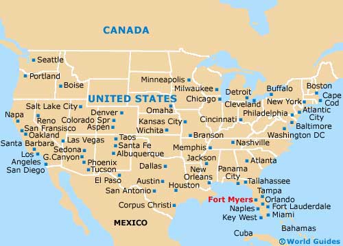
On the southeastern side of Fort Myers you will find the Southwest Florida Airport (RSW), an important regional hub serving both national and international airlines, together with a selection of well-known car hire firms. The city's Greyhound bus station stands on Peck Street and features regular services to Miami, Orlando and Tampa, all of which can be reached in approximately four hours. Buses for Fort Myers Beach leave at regular intervals from both Daniels Road and Highway 41, with various pickup points along the way. These buses are run by Lee Trans.
Southwest Florida Airport (RSW) Maps: Important City Districts
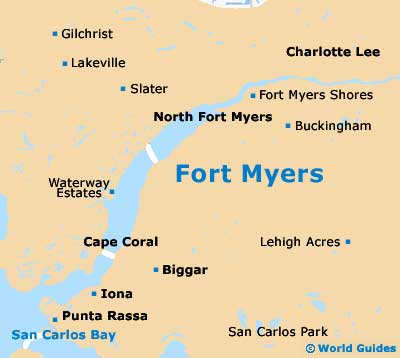
Downtown Fort Myers stands inland, just a short distance from the nearby Gulf of Mexico, next to the Caloosahatchee River. A range of local tourist information can be found at the main visitors bureau along West 1st Street, and also at the chamber of commerce, which is located on Edwards Drive.
Outside of Fort Myers you will discover a host of attractions. The 2-mile / 3-km causeway from the city is a toll road and enables you to easily drive to the Sanibel and the appealing Captiva islands. Full of natural flora and fauna, this area contains sandy beaches, lagoons and impressive mangroves, together with a range of popular water sports.
USA Map
Florida Map

Fort Myers Map